Assets & infrastructure
One map the whole administration works on
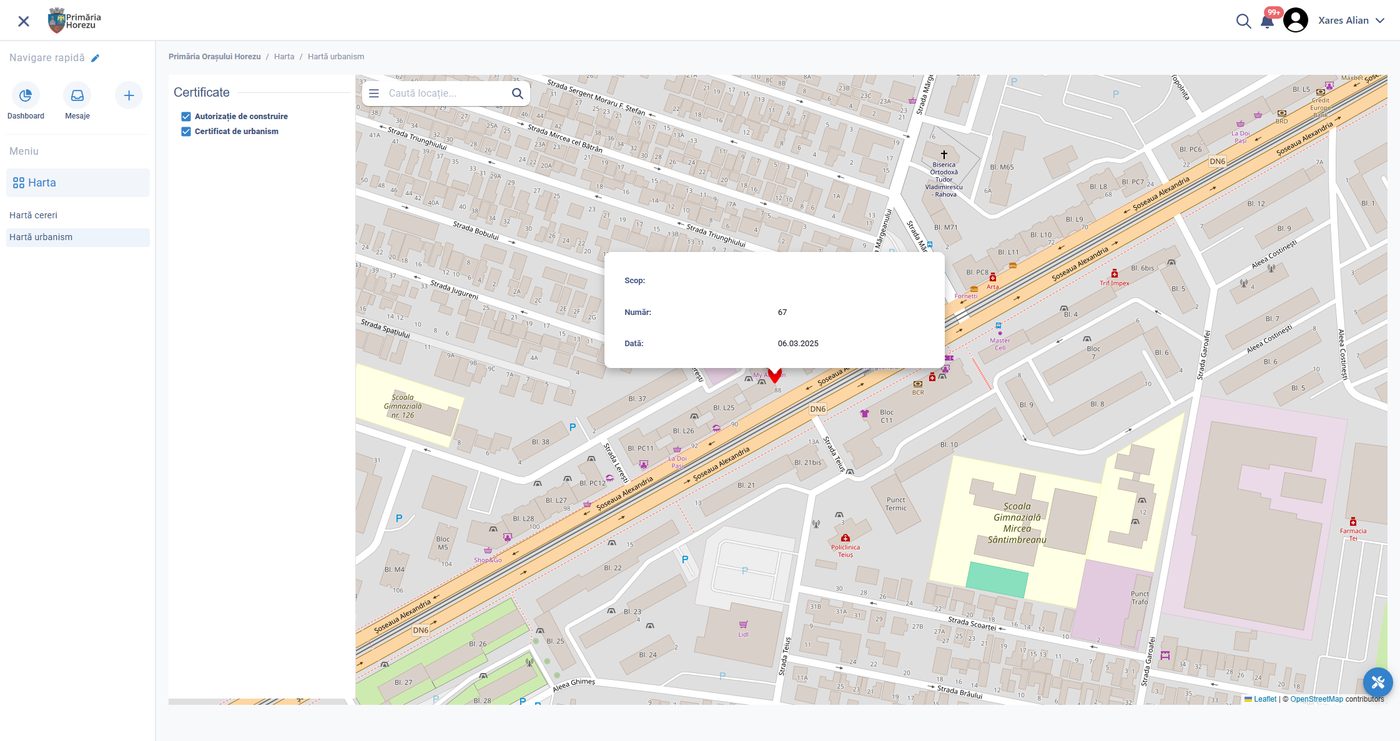
The spatial layer beneath permits, works, assets, inspections and citizen reports — internal for departments, published for residents.
Why it matters
One map the whole administration trusts
Administrations often run several maps: one in planning, one in utilities, one on the website, each with its own version of reality. A single spatial layer, updated by the processes that change it, ends the argument about which map is right.
A single spatial layer
Planning, utilities and the public site read the same geometry.
Updated by the processes that change it
A permit or a work order moves the map.
No argument about which map is right
There is one version to defend.
What it provides
A map that is part of the work
The same data serves the department, the crew in the street and the resident on the website.
Base and thematic layers
Cadastre, zoning, networks, green space and administrative boundaries.
Live operational layers
Permits, works, incidents and reports shown where they actually are.
Public maps
Published views for residents, built from the same data, not a copy.
Spatial queries
What lies within a distance, a zone or a protection area, answered automatically.
Field positioning
Crews and inspectors locating assets accurately, including offline.
Standards and exchange
Interoperable formats and services for exchange with other authorities.
How it works
Based, positioned, computed, published
Location is captured once, where the work happens, and everything else reads from it.
01
Establish the base
Cadastral and administrative layers are loaded and kept synchronised with their authoritative source.
02
Position the work
Permits, assets, jobs and reports are created against a location rather than a typed address.
03
Answer spatially
Constraints, neighbours and affected areas are computed rather than looked up by hand.
04
Publish selectively
The public sees the layers the administration chooses, updated as the underlying records change.
Outcomes
What changes
One spatial truth, and public maps that no longer need to be maintained twice.
One version of where
Departments stop maintaining rival maps.
Constraints applied automatically
A permit knows what zone it falls in.
Public information without extra work
Published maps refresh from live records.
Configured per administration
What is configured
- the layers maintained and their sources
- which layers are public and at what detail
- coordinate systems and precision
- spatial rules applied to permits and works
- symbology and map views per department
- field positioning and offline caching
- exchange services with other authorities
- update cycles for external base data
Connected to
The rest of the platform
- Permits and licensing, decided against a plot
- Assets, works and utilities networks
- Field service, for positioning and navigation
- National cadastral and spatial data services
On your own territory
See the map behind the daily work.
We load your base layers, place real permits and works on them, and show the spatial checks and the public view that follow.